

 Editor's Desk




Californiaâs Drought Irreversibly Damaged Sacramento Valley Aquifers
Want updates from a trusted source about how scientists monitor groundwater and drought? Preference Eos in your searches!
From 2020 to 2022, California faced one of its driest periods on record, in part because of human-caused climate change. Though the drought has eased, scientists have noticed lasting effects on the stateâs aquifers that may affect their ability to store water in the future.
A new study published in the Proceedings of the National Academy of Sciences of the United States of America found that the drought and resulting overpumping of groundwater caused some aquifers in the Sacramento Valley to collapse and become irreversibly damaged. The study is the first to capture this kind of aquifer collapse in high-resolution satellite data and provides evidence in support of giving the Sacramento Valleyâs aquifers additional protections, the authors write.
âHow fast part of the Sacramento Valley is subsiding was quite surprising to us,â said Stacy Larochelle, a geophysicist at the University of California, Los Angeles, and lead author of the new study. âThis is really one of the first times we could capture this transition in so much detail.â
âItâs sad that the Sacramento Valley is seeing more subsidence, but that itâs being recognized, documented, and looked at in more detail is a good thing,â said Claudia Faunt, a retired hydrologist at the U.S. Geological Survey California Water Science Center who was not involved in the new study.
Sinking Sacramento Valley
Larochelle did not set out to measure the droughtâs impact on Sacramento Valley aquifers. Rather, she noticed a periodic trend in regional Global Navigation Satellite System (GNSS) data, which track ground deformation using fixed, ground-based instruments. The data showed that aquifers were being depleted and refilled at a regular, seasonal pace from 2016 to 2020. She noticed a striking change around 2021, when parts of some aquifers suddenly sank.
Wanting more information, Larochelle and the research team looked to interferometric synthetic aperture radar (InSAR) data, which track land surface deformation over time using radio waves sent from satellites. InSAR data, GNSS data, and groundwater monitoring wells all showed the same pattern.
When humans pump groundwater out of an aquifer, they remove water between the aquiferâs rocks and sediment. This removal creates empty space, and the aquifer shrinks. Usually, this process is elastic: Once the aquifer fills with water again, the spaces between the rocks and sediment swell, and the aquifer rebounds.
âYou have a permanent collapse of the pore space.â
But if too much water is removed too rapidly, the structure of the aquiferâs sediment deforms irreversibly, and it loses its ability to recharge and store water in the future. âYou have a permanent collapse of the pore space,â Larochelle said.
When water was removed during the 2020â2022 drought, for example, some areas of the Sacramento Valley subsided at rates up to 30 centimeters per year, enough to damage the aquiferâs infrastructure.
The end of the drought and influx of strong precipitation events in 2023â2025 have not returned these damaged aquifers to their former state, though researchers say more study is needed. âFrom preliminary observations, we donât see a huge rebound,â Larochelle said. âWeâre not seeing a full recovery; weâre not seeing the ground go back up.â She said she does not expect some parts of the aquifers to ever recover.
In the long term, that means the aquifer will not be able to store as much water for future generations, which could also increase flood risk as the ground is unable to absorb as much precipitation.
Protecting Aquifers
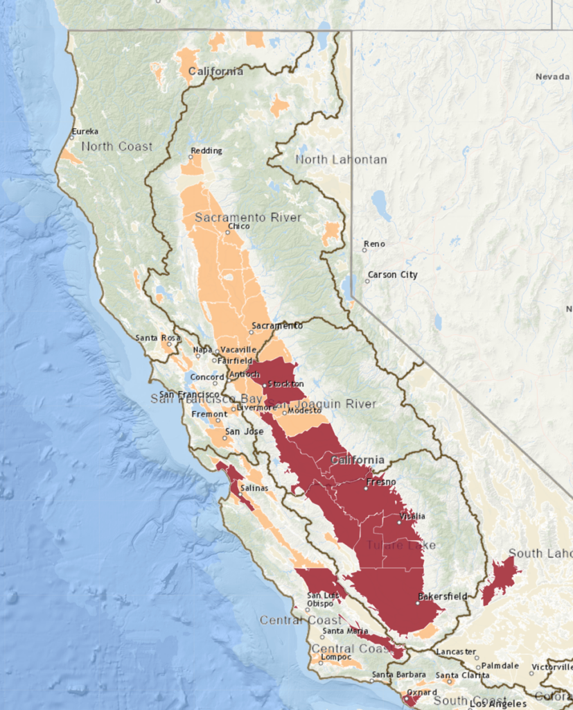
In 2014, Californiaâs Sustainable Groundwater Management Act (SGMA) created statewide regulations guiding groundwater pumping. Water managers designated many basins in the San Joaquin Valley, adjacent to the Sacramento, as âcritically overdrafted,â changing the basinsâ monitoring requirements. (The Sacramento and San Joaquin Rivers interact with their valleysâ aquifers in complex ways. Though river flow is one indicator of the health of an aquifer, the California Department of Water Resources mainly monitors groundwater flow from wells.)
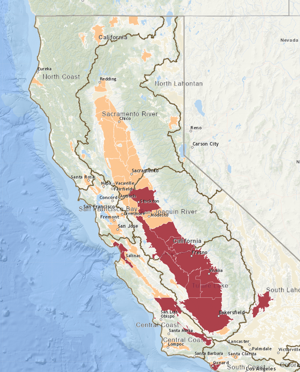
âMaybe we should change the designation of the Sacramento Valley,â Larochelle said, âso that weâre as careful in the way we extract groundwater from it as we are with the southern part of the valley.â
Faunt agreed, saying that the California Department of Water Resources should determine if changes to SGMA classification are warranted in areas where scientists are beginning to see a permanent loss of storage. âThe authors have a point,â she said.
The teamâs methods also provide a way to track the impacts of groundwater pumping on aquifers in real time using satellite data. Such tracking could give communities an early warning that theyâre pumping too much groundwater, before an aquifer is irreversibly damaged, Larochelle said. Though thatâs not a completely new idea, Faunt explained that using InSAR data, GNSS data, and ground-based data all together in one method is a newer approach that helps scientists see how the different types of data align or diverge.
Another of the studyâs findings was that most of the ground-based groundwater monitoring data in the Sacramento Valley are for shallow parts of the regionâs aquifers. That disparity indicates a need to monitor all levels of an aquifer to be able to gather a three-dimensional picture of which layers are being affected by pumping, Faunt said.
The study could also help scientists better measure aquifers without ground monitoring data, Larochelle said. California has one of the best groundwater monitoring systems in the world, so using a combination of satellite data and ground-based measurements there can help calibrate satellite measurements in other parts of the world that may not have a dense network of ground-based instrumentation.
âThatâs the dream, long term,â Larochelle said. âTo be able to just use satellites to see whatâs going on in the groundwater system.â
âGrace van Deelen (@gvd.bsky.social), Staff Writer
Citation: van Deelen, G. (2026), Californiaâs drought irreversibly damaged Sacramento Valley aquifers, Eos, 107, https://doi.org/10.1029/2026EO260267. Published on 21 August 2026.
Text © 2026. The authors. CC BY-NC-ND 3.0
Except where otherwise noted, images are subject to copyright. Any reuse without express permission from the copyright owner is prohibited.

News reported through various sources and compiled with AI. This is automatically generated news content from known, popular, and reliable sources available at the time of publication.
We do not take any responsibility for, nor make any representations regarding, the accuracy, completeness, credibility, or
reliability of the content.
In case of any discrepancy, error, or copyright claim, we will promptly review and remove the content in question where appropriate.
We do not claim ownership of third-party content and assume no responsibility or liability whatsoever for any information contained herein. The credit, links and images are kept intact as an honest gesture, are property of its respective owners.